EXPLORE Ilulissat Icefjord with this slideshow, check the location map and get all the facts and information below.
For slideshow description see right or scroll down (mobile). Slideshow loads automatically (this may take a few seconds to start)

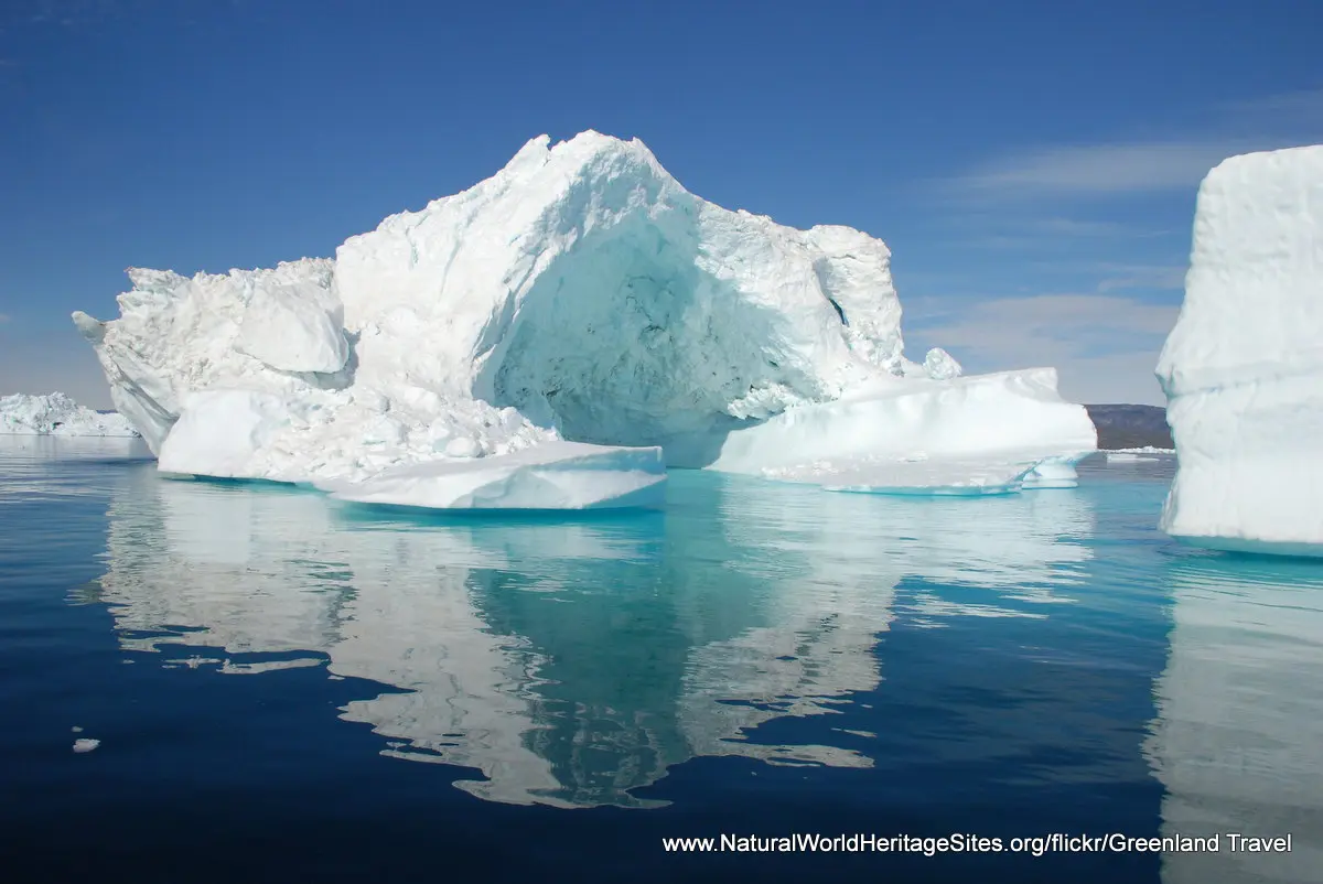
Location and Values: Ilulissat Icefjord lies at the mouth of an enormous, ancient glacier known as Sermeq Kujalleq, a ‘river of ice’ that discharges about 40 km3 of ice into the sea each year. Located on the western margins of the Greenland icecap, about 250km inside the Arctic Circle, it is one of the fastest and most active glaciers in the world. The glacier has a catchment area of about 110,000 km2 (6.5% of the Greenland Icecap), with the world heritage site occupying the ice stream from its sea mouth to the 1,200m contour, about 80-85km inland. In this area the ice stream forms a narrow well-defined channel approximately 3-6km wide, moving at a rate of about 40m each day. The calving of the glacier as it drops huge chunks of ice into the fjord, where icebergs of every shape and size fill the landscape, creates an awe-inspiring experience of sound and sight.
The Greenland icecap is the only remnant in the northern hemisphere of the continental ice sheets that existed during the last Ice Age, in the Quarternary period about 250,000 years ago. The oldest ice dates back to this time and the icecap holds a detailed record of past climate change and atmospheric conditions (in trapped air bubbles) for the entire period since it was formed. As one of the most accessible places on the Greenland icecap, Illulisat Icefjord has been studied in detail for over 250 years and has helped develop our understanding of natural cycles of climate change and icecap glaciology.
Conservation Status and Prospects. According to IUCN’s Conservation Outlook Assessment (2020) the conservation status of the Ilulissat Icefjord is ‘good, with some concerns’. The IUCN report notes that climate change is already affecting the site and will result in significant changes in the glacial landscape as well as plant and animal life. Protection and management of the site is considered to be mostly effective, but there are some concerns over possible future developments as tourism demand increases and commercial fisheries are developed at Ilulissat.
Links:
Google Earth
Official UNESCO Site Details
IUCN Conservation Outlook
UNEP-WCMC Site Description
Slideshow description

The slideshow ‘tells the story’ of the Ilulissat Icefjord with a portfolio of photos that illustrate the dramatic landscapes in the icefjord filled with gleaming icebergs floating in the deep blue tidal waters. Visitors are able to get up close to these spectacular ice formations in a variety of craft from huge cruise ships to single-person sea kayaks, and perhaps get a glimpse of the tail of a killer whale as it dives, as well as some of the bird life. The land at the margins of the fjord provides further vantage points, and some interesting opportunities to appreciate the arctic tundra vegetation. In winter the fjord is completely frozen over and locals use huskies to pull sleds through the snow-covered landscape.
The following Flickr photographers are acknowledged with thanks for their contributions to this slideshow: Bill Ward, Goran Ingman, Greenland Travel, Guido Appenzeller, helen@littlethorpe, Ralph Earlandson, twiga269, Terry Feuerborn, Patrick Rasenburg, Lisa Ouellette and ulalume.
Factfile
Website Category:
Earth Features
Area: 3,998 km2
Inscribed: 2012
UNESCO Criteria:
- Exceptional natural phenomenon (vii);
- Outstanding natural beauty (vii);
- Geological features (viii);