EXPLORE West Norwegian Fjords – Geirangerfjord and Nærøyfjord with this slideshow, check the location map and get all the facts and information below.
For slideshow description see right or scroll down (mobile). Click to view slideshow

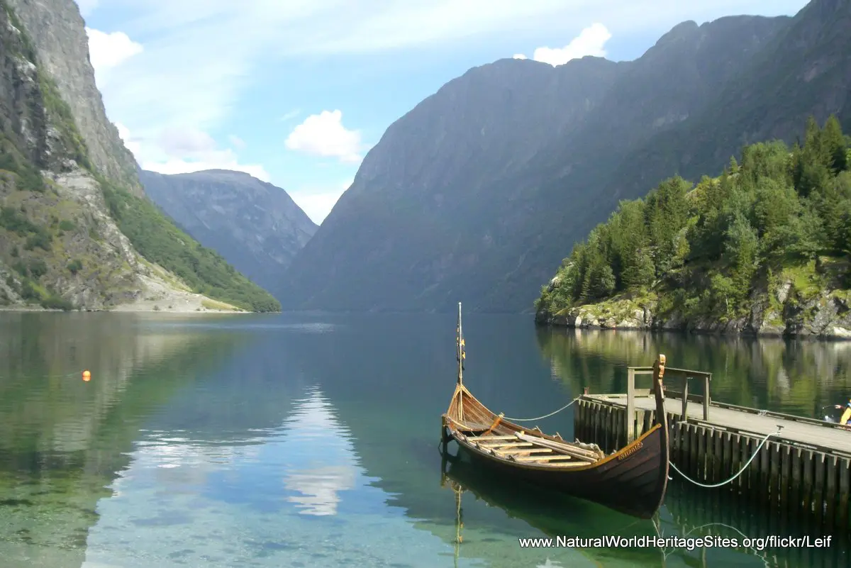
Location and Values: The West Norwegian Fjords – Geirangerfjord and Nærøyfjord are classic examples of the upper sections of two of the world’s longest and deepest fjords, located about 120 km from each other is south-western Norway. They are scenically spectacular and demonstrate all the typical features of a fjord landscape and its geological evolution. These include deep rock basins that reach far below sea level, classic drowned U-shaped valleys, steep cliffs, glaciers, moraines, hanging valleys and waterfalls. The ice and wave-polished rock surfaces of the steep fjord sides expose superb cross-sections through the bedrock. The fjord landscape also reveals a vivid record of the ‘isostatic rebound’ of the earth’s crust that happened when the massive glaciers and ice sheet that lay here during the Pleistocene ice age melted and the area was relieved of its weight.
Conservation Status and Prospects. According to IUCN’s Conservation Outlook Assessment (2020) the conservation status of the West Norwegian Fjords – Geirangerfjord and Nærøyfjord is ‘good’. The IUCN report notes that the geological and scenic values of the site, which are the basis of its world heritage listing, are not under any significant threat. However some other aspects of the environment and visitor experience may be affected by the increasing number of cruise ships that are visiting the fjords, and the associated tourism impacts such as harbor infrastructure development and pollution.
Links:
Google Earth
Official UNESCO Site Details
IUCN Conservation Outlook
UNEP-WCMC Site Description
Slideshow description

The slideshow ‘tells the story’ of the West Norwegian Fjords – Geirangerfjord and Nærøyfjord with a portfolio of photos that illustrate the landscape features of this outstanding place starting with Geirangerfjord. Most of the photos are taken from cruise vessels that navigate the fjords, showing the spectacular scenery, waterfalls, geological features and some of the old farm buildings perched on the sides of the fjord, now mostly abandoned. The slideshow concludes with a short selection of photos from Nærøyfjord.
The following Flickr photographers are acknowledged with thanks for their contributions to this slideshow: D. Convertini, Alasdair, E. Kuselbauer, Farkhod Fayzullaev, Markus Trienke, Nadja Edler, Regan Vercruysse, Rimante Paulauskaite, Thomas Hahusseau, Tristan Taussac, Vasile Cotovanu, BallooninaSock, crtaylor243, Dave Sandford, David Schroeder, Guy Chaillou, Ken Douglas, Leif and Richard Mortel.
Factfile
Website Category: Earth Features
Area: 1,227 km2
Inscribed: 2005
Criteria:
- Outstanding natural beauty (vii);
- Geological features (viii);