EXPLORE the Talamanca Range – La Amistad Reserves / La Amistad National Park with this slideshow, check the location map and get all the facts and information below.
For slideshow description see right or scroll down (mobile). Click to view slideshow

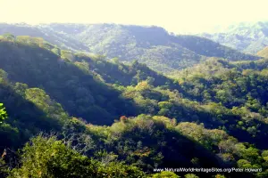
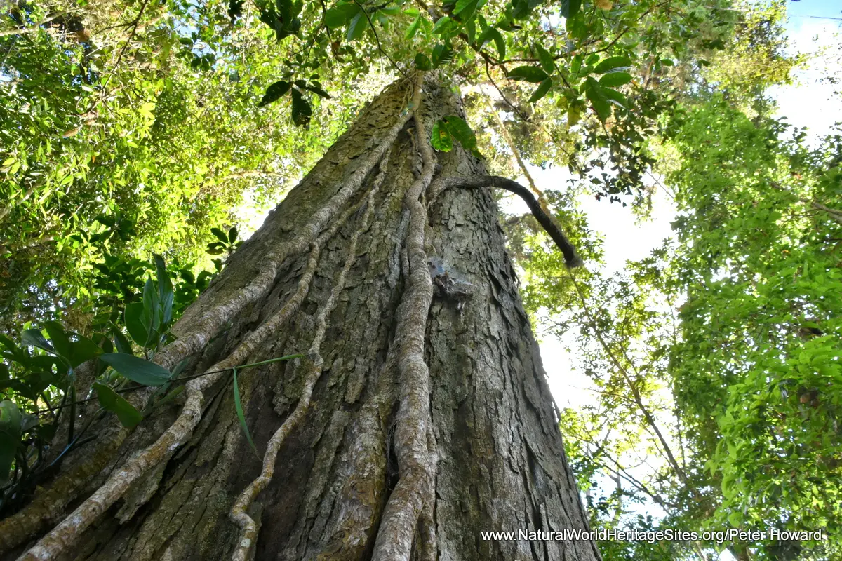
Location and Values: The Talamanca Range – La Amistad Reserves / La Amistad National Park is an extensive complex of adjoining protected areas straddling the border between Costa Rica and Panama along the ridge of non-volcanic mountains that forms this part of the ‘backbone’ of Central America. The conservation complex covers an exceptional range of altitude from the lowlands to the peak of Cerro Chirripo at 3,819m, and a corresponding diversity of ecosystems. These include various types of tropical rainforest, oak forests, cloud forests and rare high altitude bogs and grasslands. The site’s location on the geologically young land bridge between North and South America means that it serves as an ‘ecological crossroads’ for fauna and flora from both sub-continents. It supports an exceptionally rich diversity of species (10,000 higher plants, 215 species of mammal and more than 600 bird species), with a high degree of endemism and concentration of rare and endangered species. Its higher elevations provide spectacular landscapes with evidence of Quaternary glaciations, including cirques, U-shaped valleys and glacial lakes. It is one of the few sites globally that satisfies all four of the world heritage natural criteria, recognizing its exceptional natural beauty, geological significance, dynamic ecological processes and outstanding biodiversity values.
Conservation Status and Prospects. According to IUCN’s Conservation Outlook Assessment (2017) the conservation status of the Talamanca Range – La Amistad Reserves / La Amistad National Park is of ‘significant concern’. The IUCN report notes that the current threats to the site’s values and integrity include the impact of dams that have changed the hydrological regimen and associated ecosystems and processes, and caused loss of natural terrestrial and aquatic habitats. The proposed construction of new dams would impose additional pressure on the site. The IUCN report also notes some localised illegal logging and encroachment for farming and ranching. The highest potential threat to the world heritage site in the long term is from climate change.
Links:
Google Earth
UNESCO Official Website
IUCN Conservation Outlook
UNEP-WCMC Site Description
Birdlife IBA
Slideshow description

The slideshow ‘tells the story’ of the Talamanca Range – La Amistad Reserves / La Amistad National Park, showing its landscapes, habitats, plants and animals, and illustrating some of the threats and conservation needs. The photos were taken by Peter Howard during a visit to the Costa Rican side of the trans-frontier site in January 2019. The slideshow starts in the cloud-forests of the Tapanti National Park where the Inter-American highway cuts through the Talamanca Range south of the Costa Rican capital of San Jose. Here red, yellow, orange and green bromeliads perch precariously on the trees’ upper branches, sitting alongside great cushions of moss and curtains of ‘old man’s beard’. The cloud forests are home to the spectacular resplendent quetzal (a medium-sized bird adorned with bright metallic plumage), while other parts of the park provide habitat for rarely-seen species such as ocelots, macaws, white-faced capuchin monkeys, spider monkeys, and numerous species of snakes. The Inter-American highway passes along the boundary of the world heritage site, over the high pass of the Cerro De la Muerte (3,451m) marking the northernmost extent of the high-altitude paramo, a shrub and tussock grass habitat. A short walk from the main road to the summit of Cerro La Asuncion (3,335m) provides easy access to this unusual habitat (within the Tapanti National Park). The slideshow continues in Chirripo National Park, which includes Costa Rica’s highest peak and its remarkable geological features signifying past glacial activity. Hiking to the higher elevation of Chirripo is highly restricted and requires advance planning and reservation, so the photos here are limited to the lower and medium elevations, illustrating the park’s cloud forests, landscape features, animals and plants.
Factfile
Website Category: Tropical & Sub-tropical Forests;
Area: 5,700 km2
Inscribed: 1983 (Extended 1990)
Criteria:
- Outstanding natural beauty (vii);
- Geological features (viii);
- Ecological processes (ix);
- Natural habitat for biodiversity (x);
- Significant number of rare, endemic and/or endangered species (x)