EXPLORE the Galapagos Islands with this slideshow, check the location map and get all the facts and information below.
For slideshow description see right or scroll down (mobile). Click to view slideshow

Location and Values: The Galapagos Islands lie on the equator in the eastern Pacific, about 1000 km from the South American mainland. The archipelago includes 19 large volcanic islands, surrounded by one of the largest marine reserves in the world (133,000 km2). The Galapagos Islands are famous for inspiring Charles Darwin’s theory of evolution by natural selection following his visit in 1835. He observed that each island supported populations of closely related, but distinctly different, species of animals and plants – finches, mockingbirds, land snails, and giant tortoises – and concluded that these must have developed in response to the particular environmental conditions on each island, through the evolutionary processes of ‘adaptive radiation’. The Galapagos Island archipelago was the first site to be inscribed on the world heritage list, more than 40 years ago, under all four of the convention’s natural criteria. It is not only of immense scientific importance, but also an increasingly popular visitor destination where people can observe and interact with extraordinary wildlife – sea lions, marine iguanas, giant tortoises, boobies and the like – at very close proximity, due to the fearless nature of the animals.
Conservation Status and Prospects. According to IUCN’s Conservation Outlook Assessment (2017) the conservation status of the Galapagos Islands is of ‘significant concern’. The IUCN report notes that the overall level of threats remains very high in particular due to (1) illegal fishing activity in and around the marine reserve; (2) the long-term effects of invasive species on native ecosystems; (3) the effects of extreme weather events and climate change, and (4) the impact of a rapid expansion of tourism and new tourism infrastructure.
Links:
Google Earth
UNESCO Official Website
IUCN Conservation Outlook
UNEP-WCMC Site Description
Birdlife IBA
Slideshow description

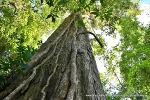
The slideshow ‘tells the story’ of the Galapagos Islands, showing the landscapes of each of the main islands, the different habitats, plants and animals, and illustrating some of the threats and conservation needs. Most of the photos were taken by Peter Howard during a visit in January 2019, with additional material by Sue Stolton and Nigel Dudley (Equilibrium Research) and Mark Davies. The Galapagos are geologically very young compared with other oceanic island archipelagos, and the slideshow illustrates the features which characterize the differences between the older islands of San Cristobal and Espanola in the east (which are three to five million years old) and the younger islands of Isabela and Fernandina in the west (which are only about one million years old and still volcanically active). Although most of the area of the world heritage site belongs in the marine realm, the slideshow focuses on island life, which is strongly influenced by ocean currents (especially cold currents from the south). The slideshow begins in the east, with photos of albatross (normally a bird of Antarctica and the southern oceans) nesting on Espanola; followed by a series of photos from San Cristobal which show marine iguanas and sea lions at Carolla Beach; giant tortoises at the tortoise breeding centre, and the pristine beach at Puerto Chino. The road between Puerto Chino from the main port town of Puerto Baquerizo Moreno traverses the cultivated highlands, where a much cooler, wetter climate enables cattle to be kept, bananas and coffee to be grown, and natural cloud forests to flourish.
From the highlands of San Cristobal the slideshow moves to the central island of Santa Cruz, and the main port town of Puerto Ayora. Here, residents and visitors alike share the esplanade, streets and benches with the animals – sea lions, iguanas and pelicans. The photos of Santa Cruz Island feature the Charles Darwin Research Station (with its breeding populations of giant tortoises and land iguanas); the natural swimming channel of Las Grietas; the white-sand beach of Tortuga Bay; the privately owned ‘giant tortoise’ reserve of Rancho Primicias in the highlands, and the nearby lava tunnels and sink holes of Los Gemelos.
While a quarter of Galapagos visitors take a multi-day live-aboard cruise around the islands, the majority prefer a land-based visit, with day excursions to other areas. From Puerto Ayora one of the most popular day trips visits the scenically-attractive Bartolome Island, with its characteristic pinnacle rock and dramatic volcanic cones and lava fields. This trip typically includes an opportunity to snorkel in a sheltered bay on nearby Santiago Island, with plenty of time during the day to scan the ocean for flocks of petrels and other seabirds, flying fish, dolphins and other marine life.
The final part of the slideshow features Isabela Island, where sharp-eyed visitors may spot penguins on the rocks around the bay at Puerto Villamil. Another speciality of this western part of the archipelago is the flightless cormorant. Isabela is the largest island and a more ‘laid back’ place for visitors than the two other main islands. Its abundant attractions include the recently-active Sierra Negra volcano, with its dramatic ‘frozen’ lava flows, and a couple of outstanding offshore locations for snorkeling and diving with turtles and sharks amongst the lava rocks and underwater tunnels of Los Tuneles and Los Tintoreras.
Factfile
Top 10: One of the ‘Top 10’ sites
Website Categories: Islands; Earth Features
Area: 140,665 km2 (7,665 km2 land area)
Inscribed: 1978 (Extended 2001)
Criteria:
- Outstanding natural beauty (vii);
- Geological features (viii);
- Ecological processes (ix);
- Natural habitat for biodiversity (x);
- Significant number of rare, endemic and/or endangered species (x)