EXPLORE Sangay National Park with this slideshow, check the location map and get all the facts and information below.
For slideshow description see right or scroll down (mobile). Click to view slideshow

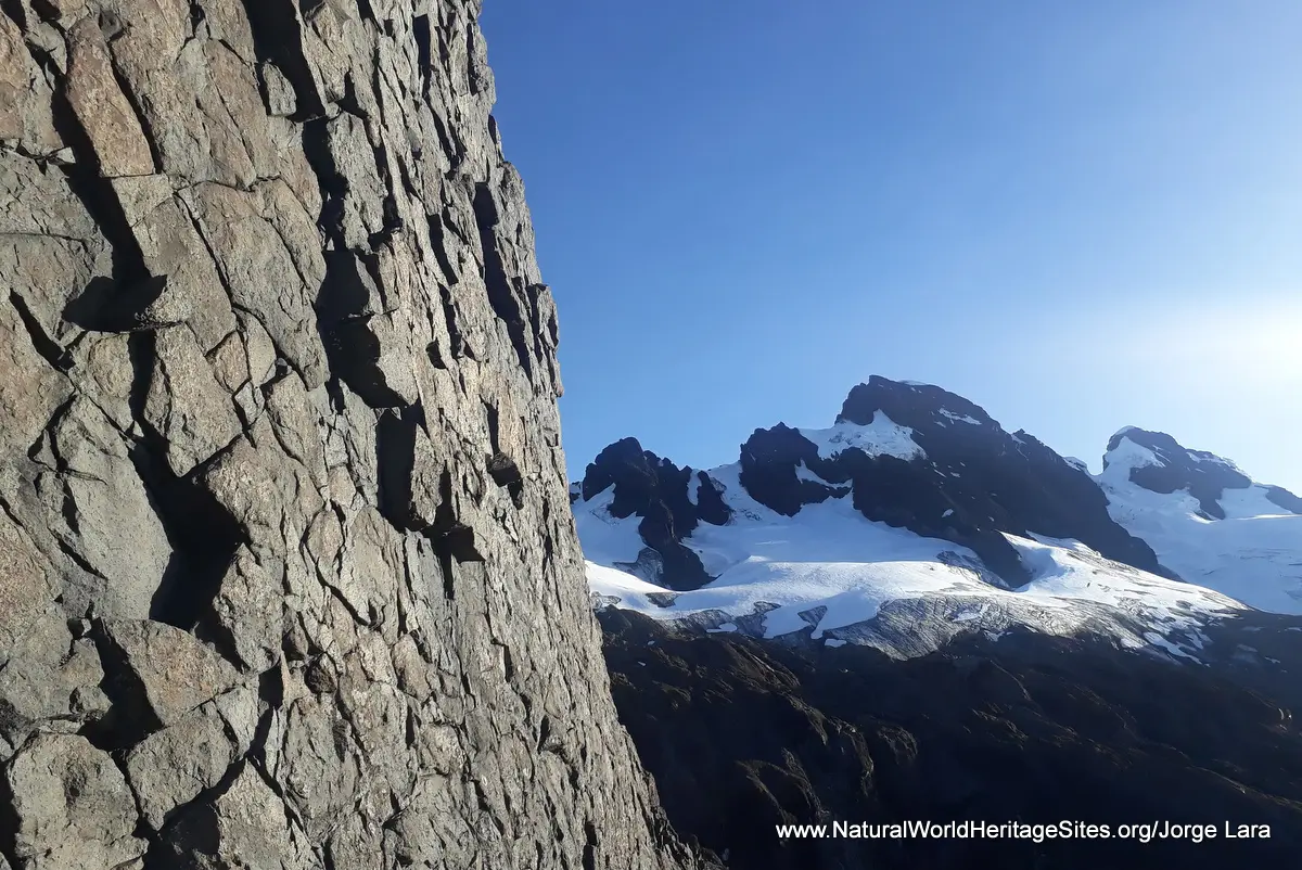
Location and Values: Sangay National Park lies close to the equator along the eastern flank of the Andes mountains in Ecuador. It is one of the few places in the world that satisfies all four of the world heritage natural criteria. Its outstanding natural beauty and aesthetic qualities are complemented with exceptional geological, ecological and biodiversity attributes. The park spans a very wide range of altitude from the Andes’ highest snow-capped volcanic peaks (Mount Altar, 5,319m) down the eastern flanks of the Andes to the Amazonian rainforest at 900m. It encompasses two active volcanoes and an exceptional diversity of habitats including glaciers and snowfields, ash and scree slopes, extensive areas of wetlands, lakes, high-altitude paramo grass and moorlands, cloud forest and tropical montane rainforest. These habitats support at least 3,000 species of flowering plant, 107 mammals and 430 birds, including many rare, endemic and/or endangered species such as the mountain tapir, spectacled bear, Andean condor and Andean cock-of-the-rock.
Conservation Status and Prospects. According to IUCN’s Conservation Outlook Assessment (2017) the conservation status of the Sangay National Park is ‘good, with some concerns’. The IUCN report notes that current threats from small-scale agriculture, grazing, hunting and plant extraction are relatively minor, while the impacts of road construction and hydroelectric dams in the vicinity of the park are more significant. Climate change is becoming an increasingly significant threat with particular consequences for the melting of the park’s glaciers and maintenance of its high altitude paramo grassland ecosystem.
Links:
Google Earth
UNESCO Official Website
IUCN Conservation Outlook
UNEP-WCMC Site Description
Birdlife IBA
Slideshow description

The slideshow ‘tells the story’ of Sangay National Park, showing its landscapes and habitats, plants and animals, and illustrating some of the threats and conservation needs. Many of the photos were taken by Ecuadorean guide Jorge Lara over a period of 20 years, during the course of many mountaineering expeditions into different parts of the park. This includes a rare ascent over the ash fields of Sangay itself, one of the world’s most consistently active volcanoes, where a mountain tapir was photographed, alongside other plants and animals. Jorge’s portfolio of photos includes many spectacular far-reaching views of the high Andean peaks, while other images by Peter Howard (from a visit in January 2019) provide an impression of more typical weather conditions and visibility in these wet equatorial mountains. Peter’s photos illustrate the paramo landscapes around the Atillo lakes, and some features of the cloud forest along the main Riobamba-Macas road which cuts through the park. The slideshow ends with photos of a two-day trek to the Altar volcano crater lake, with its surrounding peaks emerging intermittently from the swirling clouds, while moss-draped branches and ankle-deep mud testify to the typical environmental conditions that prevail here, even during the ‘dry’ season!
Factfile
Website Category: Mountains; Earth Features
Area: 2,719 km2
Year of Inscription: 1983
Criteria:
- Exceptional natural phenomenon (vii);
- Outstanding natural beauty (vii);
- Geological features (viii);
- Ecological processes (ix);
- Natural habitat for biodiversity (x);
- Significant number of rare, endemic and/or endangered species (x)