EXPLORE Australia’s Fraser Island with this slideshow, check the location map and get all the facts and information below.
For slideshow description see right or scroll down (mobile). Click to view slideshow

Location and Values: Australia’s Fraser Island is located off the east coast, in southern Queensland. It is the largest sand island in the world, created by the processes of longshore drift over many millennia, with dune systems that are continuing to evolve. The island is 122 km long and features long pristine beaches, coloured sand cliffs, extensive areas of rainforest growing on ancient dunes and half the world’s ‘hanging lakes’ perched on sand dunes.
Conservation Status and Prospects. According to IUCN’s Conservation Outlook Assessment (2017) the conservation status of the Fraser Island is ‘good with some concerns’. The IUCN report notes that ‘Fraser Island has been viewed as a model in participatory conservation management between many different stakeholders and a number of excellent management plans for a variety of issues have been put in place. The state of the site’s World Heritage values remains relatively good and significant human and financial resources are being directed to the management of the threats to these values. However, pressures from tourism and recreational use, as well as climate change, will require continuing monitoring and increased management efforts to ensure preservation of the site’s values in the long-term.’
Links:
Google Earth
Official UNESCO Site Details
IUCN Conservation Outlook
UNEP-WCMC Site Description
Birdlife IBA
Slideshow description

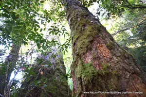
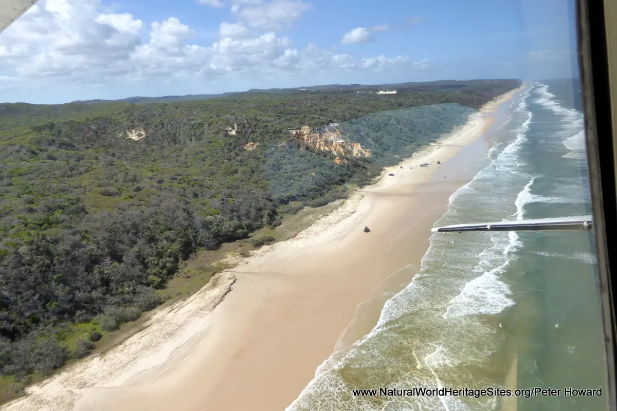
The slideshow ‘tells the story’ of Australia’s Fraser Island with a portfolio of photos by Peter Howard from a visit in January 2018. Most of the island is designated National Park with few inhabitants so there are no surfaced roads and the nature of the sandy terrain makes access by motorized transport extremely challenging. Nevertheless, the island is a popular visitor destination (and playground for four-wheel-drive vehicle owners!) with most visitors joining tour groups that traverse the deep sandy tracks and beaches in special high-clearance vehicles. The slideshow illustrates the main attributes of the island that are seen on a typical tour, starting with the ferry crossing from Hervey Bay and, on arrival, proceeding through various types of dune forest to the stunningly beautiful Lake Mackenzie (where visitors can soak up the sun on the gleaming white beaches, or go for a swim), before proceeding through some magnificent rainforest with giant Eucalypts and fig trees, groves of palm, sandy clear-water creeks and some notable species of ferns, cycads and birds. Fraser Island is particularly noteworthy for its dingoes, wild dogs that have been exterminated in many other parts of Australia. The eastern side of the island is bounded by the dune-backed ‘Seventy Five Mile Beach’ which provides a firm surface for fast driving further north, and a landing strip for light aircraft. The Pinnacles is a multi-coloured sand cliff that serves as a landmark along the way, and (with tides, winds and weather on your side) may provide an opportunity to take a quick overflight with Fraser Air to see the interior of the island from above. The extensive forest-clad dunes and hanging lakes are best seen from above in this way, as is the stranded rusting shipwreck of the SS Maheno. On the return journey a quick stop at the crystal-clear waist-high fresh waters of Eli Creek, behind the dunes, makes for a refreshing break.
Factfile
Website Categories: Islands; Earth Features
Area: 1,840 km2
Inscribed: 1992
Criteria:
- Exceptional natural phenomenon (vii);
- Outstanding natural beauty (vii);
- Geological features (viii);
- Ecological processes (ix);