EXPLORE the Desembarco del Granma National Park with this slideshow, check the location map and get all the facts and information below.
For slideshow description see right or scroll down (mobile). Click to view slideshow

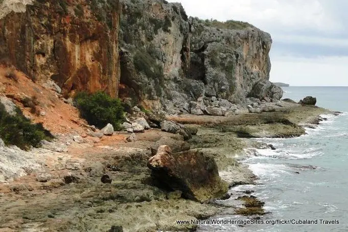
Location and Values: The Desembarco del Granma National Park is located in southern Cuba and protects a spectacular series of uplifted marine limestone terraces near Cabo Cruz at the western end of the Sierra Maestra Mountains. It is the world’s largest and best preserved coastal limestone terrace system, which extends from 180 below to 360 metres above sea level. The terraces are the result of ongoing geological processes associated with the interaction of two of the Earth’s tectonic plates (the Caribbean and North American Plates) in combination with fluctuations in sea levels due to long-term changes in Earth’s climate. Twenty percent of the site lies within a designated marine zone, while the terrestrial portion is characterized by a scenically-spectacular landscape with impressive coastal cliffs, escarpments, cave systems, river canyons and giant sinkholes.
Conservation Status and Prospects. According to IUCN’s Conservation Outlook Assessment (2020) the conservation status of the Desembarco del Granma National Park is ‘good, with some concerns’. The IUCN report notes that the geological and scenic values for which the site is listed are intact and unlikely to be seriously affected by any anticipated threats. However, it identifies climate change as the most serious potential threat, with likely impacts on marine and terrestrial biodiversity. Invasive species, an increase in tourism and pollution are also identified as low-level threats to the integrity of the site.
Links:
Google Earth
Official UNESCO Site Details
IUCN Conservation Outlook
UNEP-WCMC Site Description
Birdlife IBA
Slideshow description

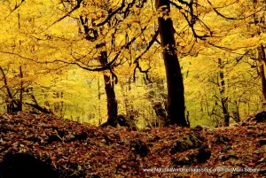
The short slideshow ‘tells the story’ of the Desembarco del Granma National Park with a portfolio of photos that illustrate its landscape features and geology. It starts with views of the marine zone and coastal cliffs, followed by some of the inland karst features, including a cave and a massive sinkhole. There are a couple of (low resolution) images of the limestone terrace system, and well as general views of the coastal landscape around the Cabo Cruz area.
The following Flickr photographers and other sources are acknowledged with thanks for their contributions to this slideshow (as credited in the watermark of each photo): Anon, Cesar O., Batista Sanchez, Directorio Latinamericano de Recursos Patrimoniales, Habitat, Holiplus, Cubaland Travels, Patrimonio, Pinterest, TripAdvisor, Twitter and Umbrella Travel.
Factfile
Website Category:
Caves & Karst
Area: 326 km2
Inscribed: 1999
UNESCO Criteria:
- Exceptional natural phenomenon (vii);
- Outstanding natural beauty (vii);
- Geological features (viii);