EXPLORE East Rennell with this slideshow, check the location map and get all the facts and information below.
For slideshow description see right or scroll down (mobile). Click to view slideshow

Location and Values: East Rennell covers the southern part of Rennell Island in the far south of the Solomon Island group in the western Pacific. Rennell Island is the world’s second largest raised coral atoll (which, like Aldabra and Henderson Island – two other sites on the world heritage list – has been raised above sea level by tectonic forces). The world heritage area of East Rennell protects the atoll’s lagoon (Lake Tegano) and a narrow ring of low-lying limestone hills and coral reefs that encloses it. The island is covered in dense tropical forest, and is an important ‘natural laboratory’ for studies of island biogeography and the evolution of species, with many endemics. Its flora includes elements originating from the relatively impoverished Pacific Islands to the east and the much richer Melanesian flora to the west, with 10 endemic plant species recorded. There are 43 species of breeding birds, of which 21 (49%) are endemic species/sub-species.
The lake’s brackish waters harbour an endemic sea snake and its forests have an endemic fruit-eating bat, the Rennell flying-fox. The marine area of the site extends offshore to depths of about 1,000m, protecting a significant component of the diverse coral reef ecosystems for which the Solomon Islands are recognized.
Conservation Status and Prospects. According to IUCN’s Conservation Outlook Assessment (2020) the conservation status of East Rennell is ‘critical’. The site has been inscribed on the List of World Heritage In Danger since 2013 in recognition of a growing number of significant threats to its conservation. The area is managed by the local community under a customary tenure and governance system, but this lacks formal government recognition and the community does not have the resources and capacity to provide the necessary world-class management.
At the time of inscription there was a population of about 1,200 people living in four villages within the site, practicing traditional subsistence lifestyles. However, the population is now declining and experiencing significant social change, leading to unsustainable livelihood practices. The report emphasizes that local people lack suitable income-generating activities that are compatible with sustainable use of natural resources, while law enforcement is ineffective. Furthermore, the ecology of Lake Tegano is being affected by sea level rise and an increase in salinity. In addition, there are development pressures close to the site boundaries, where bauxite mining and logging are taking place.
Links:
Google Earth
Official UNESCO Site Details
IUCN Conservation Outlook
UNEP-WCMC Site Description
Birdlife IBA
Slideshow description

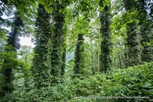
The slideshow ‘tells the story’ of East Rennell with a portfolio of photos that illustrate its landscape features, settlements, livelihoods and marine life. The first part of the slideshow is centred around Lake Tegano, showing the limestone cliffs and forests around the lake, as well as some of the small rugged limestone islands in the lake. From the top of the hills that enclose the lake, the fringing coral reefs of the outer coastline are clearly visible. Four small settlements (inhabited by peoples of Polynesian origin) are located around the northern shores of the lake and the limestone hills nearby contain a number of small caves. The lake provides sanctuary for saltwater crocodiles and the coconut groves that hug its shores provide habitat for giant coconut crabs (the largest terrestrial arthropod in the world which can weigh up to 4kg).
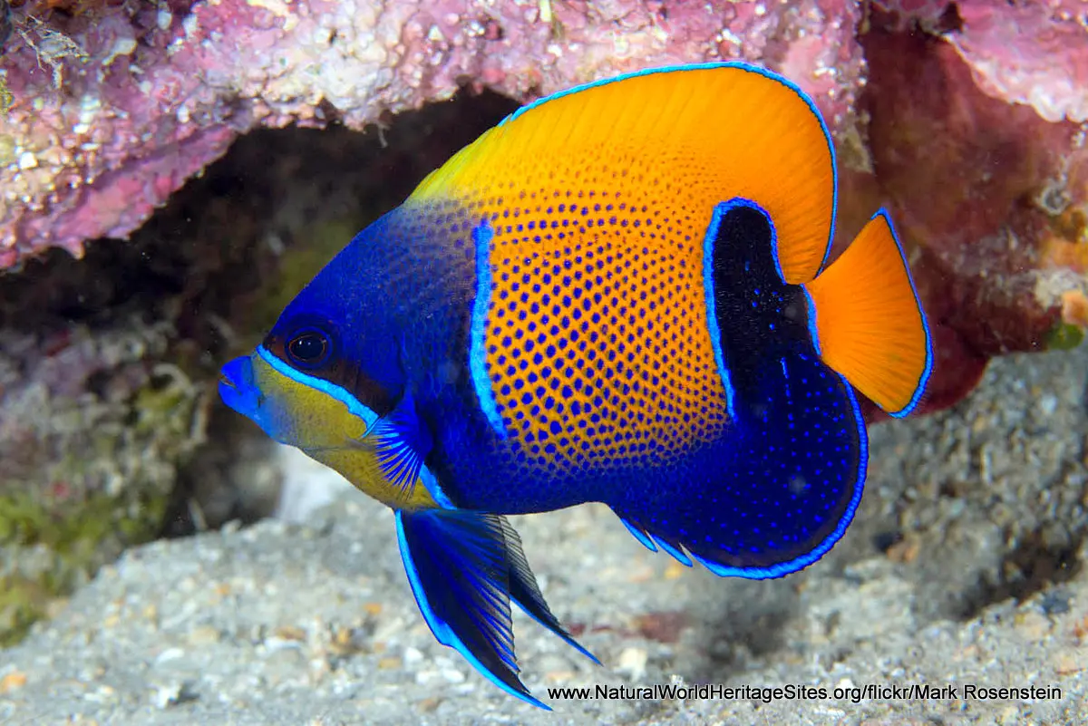
The second part of the slideshow features marine life in the fringing reefs including a variety of sharks, and shoals of pelagic fish as well as typical reef inhabitants such as clown anemone fish, colourful crinoids and sea slugs, turtles, lion fish, pipefish, wrasses and rays.
The following Flickr photographers acknowledged with thanks for their contributions to this slideshow (as credited in the watermark of each photo): KristyMay62 (for photos of Lake Tegano and the terrestrial parts of the site) and Mark Rosenstein (for underwater photos of the marine environment and its wildlife).
Factfile
WORLD HERITAGE IN DANGER
(2013 – present)
Website Category:
Islands
Area: 370 km2
Inscribed: 1998
UNESCO Criterion:
- Ecological processes (ix);