EXPLORE Pyrenees – Mont Perdu with this slideshow, check the location map and get all the facts and information below.
For slideshow description see right or scroll down (mobile). Click to view slideshow

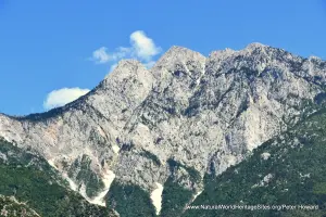
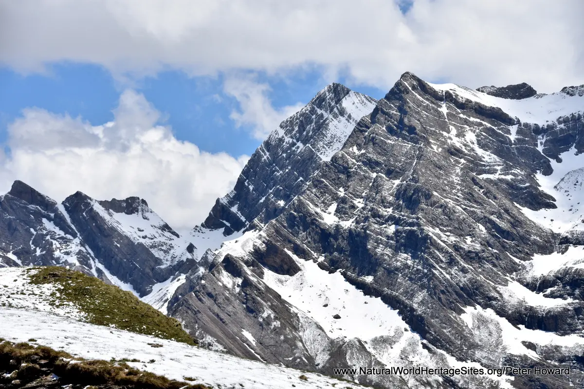
Location and Values: The Pyrenees – Mont Perdu world heritage site is located in the central Pyrenees mountains, straddling the border between France and Spain. Two thirds of the area is in Spain, coinciding with the boundaries of the Ordesa National Park (Parque Nacional de Ordesa y Monte Perdido), while the balance lies within France’s Pyrenees National Park (60% of the French sector) and an adjoining ‘buffer zone’. This is an area of outstanding natural beauty, centred around Mount Perdu (3,352m), which includes two of Europe’s largest and deepest canyons (on the Spanish side), as well as three spectacular ‘cirque walls’ dominating the glacier-carved mountain summits and alpine pastures (on the steeper French side). The high alpine pastures have been used as summer grazing for domestic stock since time immemorial and the villages, trails, stock enclosures and seasonal shelters associated with this rare traditional transhumance land-use system is recognized in the ‘mixed’ listing of the Pyrenees – Mont Perdu world heritage site under both natural and cultural criteria.
Conservation Status and Prospects. According to IUCN’s Conservation Outlook Assessment (2017) the conservation status of the Pyrenees – Mont Perdu site is ‘good, with some concerns’. The IUCN report notes that the site has remained in a good state since its world heritage listing, although there is some concern over the potential impacts of climate change, the impacts of tourism and the decline of agro-pastoral activities. Although the pastoral communities manage their use of the area in traditional ways, formal arrangements for trans-boundary cooperation were only established in 2012 and further improvements in this aspect are required.
Links:
Google Earth
UNESCO Official Website
IUCN Conservation Outlook
UNEP-WCMC Site Description
Birdlife IBA
Slideshow description

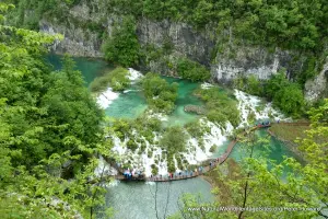
The slideshow ‘tells the story’ of the Pyrenees – Mont Perdu with a portfolio of photos by Peter Howard from a visit in June 2019. They illustrate the diversity of landscape features in this part of the Pyrenees, together with some of the typical plants and animals. The slideshow starts on the French side – with views of one of the impressive ‘cirque walls’ (the Cirque de Gavarnie) – and shows various other locations from a ‘clockwise tour’ around the French and Spanish parts of the site. Various road access points enable visitors to reach high altitude trail heads, and the second location in the slideshow is the most easterly of the three ‘cirque walls’ on the French side. This area gives the impression of a massive ‘amphitheatre’ – a steep-sided semi-circular plateau of alpine pastures surrounded by glacier-capped summits, scattered with glacial moraines, lakes and scree slopes. Moving south, across the border into Spain, the next main access point (from the east) is via the village of Tella (where there is an interesting stone-age ‘dolmen’) into the Escuain Valley. Near the village of Revilla, lammergeyers (bearded vultures) often congregate around a (private) feeding/viewing/conservation site, and (further on) a trail leads through the wooded hillsides overlooking the dramatic gorge, where griffon vultures soar overhead and can be seen perched on ledges on the cliffs. The virtual tour continues with views of the spectacular Anisclo Gorge, before continuing to the western part of the Ordesa National Park. There is an interesting visitor centre in the town of Torla, with exhibits on the natural history of the park, including the salutary tale of the recent extinction of Pyrenean ibex (in the year 2000). The most popular walk in this part of the park, illustrated here, starts at the ‘Pradera de Ordesa’ and follows the Rio Arazas through the Ordesa Valley to the spectacular Caballo waterfall. From there, if time and weather conditions permit, the trek can be extended to the Refugio de Goriz at 2,200m, where marmots and chamois may make an appearance.
Factfile
Website Categories: Mountains;
Area: 306 km2
Inscribed: 1997 (Extended 1999)
Criteria:
- Outstanding natural beauty (vii);
- Geological features (viii);
- Cultural criteria (iii,iv,v)