EXPLORE Mistaken Point with this slideshow, check the location map and get all the facts and information below.
For slideshow description see right or scroll down (mobile). Click to view slideshow

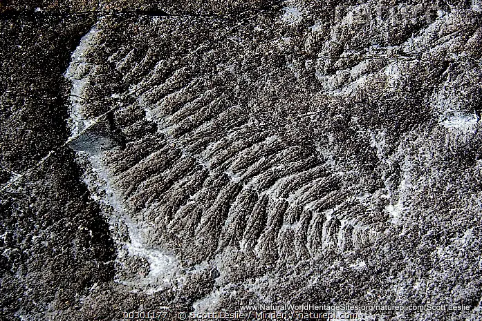
Location and Values: Mistaken Point is a 17 km-long stretch of rugged coastal cliffs on the extreme south-eastern shores of Newfoundland, Canada. Its rich fossil beds reveal the world’s oldest known examples of the first complex organisms to evolve on Earth, about 580 to 560 million years ago, after nearly three billion years of early microbial life on the planet. The cliffs at Mistaken Point originated in the deep ocean and include a 2km-thick rock sequence which preserves about 100 fossil sea-floor surfaces that provide a detailed chronology of the early evolution of complex marine life over a period of 20 million years. Throughout this period a variety of soft-bodied creatures lived on the deep-sea floor, where they were periodically buried alive under influxes of volcanic ash (as happened more recently to the human inhabitants of Pompeii), preserving them in exceptional detail. Today, the impressions of more than 10,000 of these soft-bodied ancestral animals, ranging in size from a few centimeters to nearly two metres in length, are exposed in the rock surfaces at Mistaken Point.
Conservation Status and Prospects. According to IUCN’s Conservation Outlook Assessment (2020) the conservation status of Mistaken Point is ‘good’. The IUCN report notes that the site is protected within the Mistaken Point Ecological Reserve, owned and managed by the provincial Department of Environment and Conservation. Its fossils and geological values are resilient to external treats and the site’s remote and rather inhospitable location provides a high degree of natural protection. Independent visits to the site are prohibited, so theft and damage to the fossils are prevented. Guided walks to view the fossils are provided, and the Edge of Avalon Interpretive Centre provides visitors with an understanding of the global importance of Mistaken Point to our knowledge of the development of life on Earth.
Links:
Google Earth
Official UNESCO Site Details
IUCN Conservation Outlook
UNEP-WCMC Site Description
Slideshow description

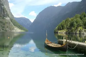
The slideshow ‘tells the story’ of Mistaken Point with a portfolio of photos that illustrate the landscape features of this remote and windswept corner of Canada, as well as some of the fossils found there. An artist’s impression of what the sea-floor would have been like in the Ediacaran Period (580 to 560 million years ago) is included.
The following Flickr photographers and other sources are acknowledged with thanks for their contributions to this slideshow: Richard Droker, Zach Bonnell, Queen’s University/Lija Flude and Guy Narbonne, Nature Picture Library/Scott Leslie, Semantic Scholar, Product of Newfoundland, and Wikipedia/Alice J. Michel.
Factfile
Website Category:
Fossil Record
Area: 1.5 km2
Inscribed: 2016
UNESCO Criterion:
- Fossil record (viii);