EXPLORE Shiretoko with this slideshow, check the location map and get all the facts and information below.
For slideshow description see right or scroll down (mobile). Click to view slideshow

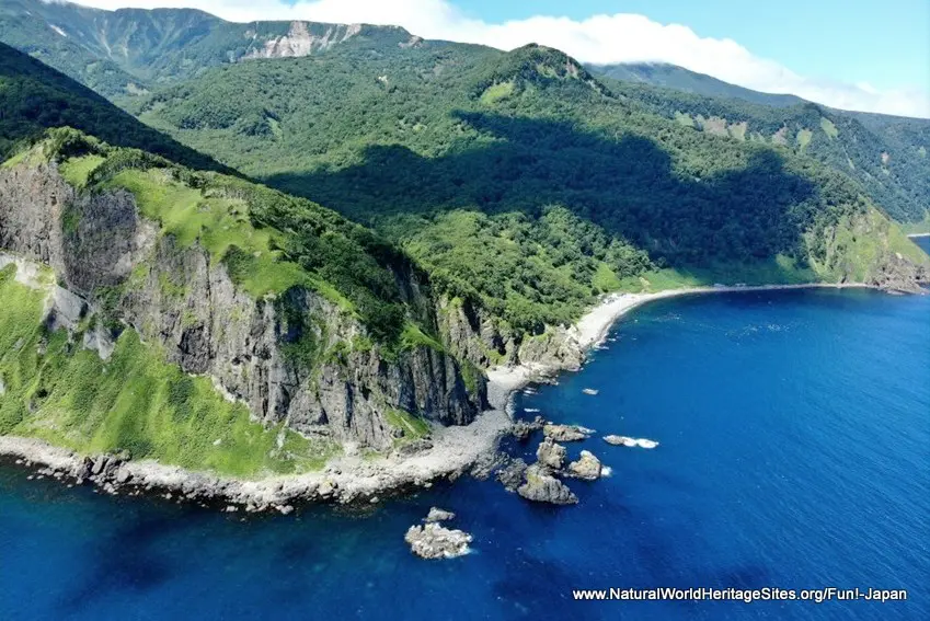
Location and Values: Shiretoko is a peninsula of volcanic peaks in the north-east of Hokkaido, Japan’s most northerly island. Two thirds of the world heritage site is land on the peninsula itself, while a third occupies adjacent coastal and marine zones. The interaction between its marine and terrestrial components is exceptional, with extraordinary marine productivity sustaining a complex feeding web that links to the land as salmonid fish move out of the sea and swim upstream to spawn in the peninsula’s many rivers where they are eaten by brown bears and fish-owls. The exceptional marine productivity is fueled by an explosive growth of phytoplankton and krill associated with the melting of sea ice in spring and a warm current in summer which brings an abundance of nutrients to the surface waters. The wealth of wildlife includes the highest recorded densities of brown bears in the world, globally important populations of threatened seabirds, an abundance of migratory birds as well as an exceptional diversity (10 species) of salmonid fish. The marine zones provide important seasonal feeding grounds for marine mammals including Steller’s sealion, seals and 12 species of cetacean (whales, dolphins and porpoises) as well as birds such as Steller’s sea eagle.
Conservation Status and Prospects. According to IUCN’s Conservation Outlook Assessment (2020) the conservation status of Shiretoko is ‘good, with some concerns’. The IUCN report identifies fisheries management as a primary concern, calling into question the existing practice of culling Steller’s sealions (within the world heritage site) to protect commercial fisheries. An additional concern is the damming of nine of the 44 small rivers that drain the peninsula, affecting salmonid fish migration in these critical waterways. This clearly impacts the important linkages between the marine and terrestrial ecosystems which underpin the area’s world heritage status. Another major long-term concern is the potential impact of a warming climate on the formation and maintenance of sea ice, since the spring ice melt drives the nutrient cycle that supports complex food webs and the large seasonal congregations of wildlife.
Links:
Google Earth
Official UNESCO Site Details
IUCN Conservation Outlook
UNEP-WCMC Site Description
Birdlife IBA
Slideshow description

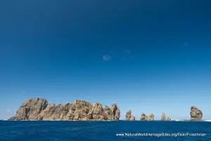
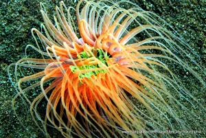
The slideshow ‘tells the story’ of Shiretoko with a portfolio of photos that illustrate the landscape features of this outstanding place, together with some of the typical marine life, plants and animals. It starts with an introductory overview of the site, followed by a series of images from different seasons around the popular Shiretokogo Lakes near the west coast, where there is an elevated walkway through one of the park’s most scenic areas, where bears and deer may be encountered. The next part of the slideshow takes in the coastal zones, cliffs, rock stacks, waterfalls and forested mountainsides that can be seen from a boat tour around the peninsula. Most visitors visit Shiretoko in summer, but for those who brave the freezing temperatures of early spring, as the sea ice is breaking up, the wealth of wildlife to be seen is extraordinary. The final part of the slideshow features some winter scenes, including the Shiretokogo Lakes and some of the larger mammals and birds that take advantage of the abundant food at this time. Hokkaido Sika deer can be easily spotted in the snow, while marine mammals include killer and humpback whales as well as Steller’s sealions. Amongst the area’s threatened species there are an estimated 2,000 Steller’s sea eagles which congregate on the ice pack at this time of year.
The following Flickr photographers and other sources are acknowledged with thanks for their contributions to this slideshow: Fun! Japan, Neil Dalphin, Nippon.com, l-v-l l-v-l, atmik, Inunami, livingnomads.com, uu-hokkaido.com, Sei F., ana-cooljapan.com, startsat60.com, Nohchi Oda, Sendai Blog, Yoshio Higuchi, Yuichi Sakaraba, Senchi, powderlife.com, irasally, veroyama, Jaque Tseng, Hajime Nakano, selected-ryokan.com, best.visithokkaido.com, Glenn Brunette, wanderwisdom.com, Gruenesmonster72, Sascha Wenninger, Robert Cummings, Cale Green, Navin75, Tony Cyphert, John Harwood and labbradolci.
Factfile
Website Categories:
Marine & Coastal
Temperate & Boreal Forests
Area: 487 km2 (plus 224 km2 buffer zone)
Inscribed: 2005
UNESCO Criteria:
- Ecological processes (ix);
- Natural habitat for biodiversity (x);
- Significant number of rare, endemic and/or endangered species (x)