EXPLORE the Los Katios National Park with this slideshow, check the location map and get all the facts and information below.
For slideshow description see right or scroll down (mobile). Click to view slideshow

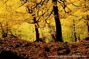
Location and Values: Los Katios National Park is located along Colombia’s border with Panama, where it forms part of a trans-boundary conservation area with neighbouring world heritage-listed Darien National Park. The area supports one of the world’s most species-rich rainforests, with exceptional levels of endemism. Its location on the isthmus connecting the North and South American continents gives it a unique biogeographical significance as a major convergence zone for plant and animal taxa. Los Katios is much smaller than Darien, making up just 11% of the total area of the combined trans-boundary conservation area. It is divided between two major regions with half its area covered by forested hills and mountains (to an elevation of 650 metres), while the other half is occupied by the alluvial flats, marshes and floodplains of the Atrato River.
Conservation Status and Prospects. According to IUCN’s Conservation Outlook Assessment (2020) the conservation status of the Los Katios National Park is of ‘significant concern’. The site was previously inscribed on the List of World Heritage In Danger from 2009 – 2015 because of significant threats from (1) illegal timber extraction, (2) renewed settlement within the park by Wounaan communities which had been re-located to areas outside the park at the time it was established, (3) fishing and hunting, (4) land clearance within the park for shifting agriculture and cattle pasture, (5) pollution and (6) potential development of major new infrastructure projects, including completion of the Pan-American highway through the Darien Gap. The latest IUCN Conservation Outlook Assessment (2020) notes that an improved security situation since 2015 has enabled the management authority to address many of these threats. Law enforcement has been improved, and negotiations are underway with the Wounaan communities to develop appropriate systems of sustainable use that recognize the rights of local people now living within the park while also protecting the area’s important world heritage values. One of the main concerns is that the improved security situation may enable implementation of major infrastructure projects (such as the Pan-American highway) that have not been possible previously.
Links:
Google Earth
Official UNESCO Site Details
IUCN Conservation Outlook
UNEP-WCMC Site Description
Birdlife IBA
Slideshow description

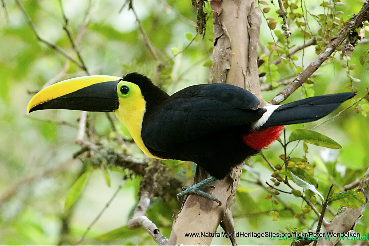
The slideshow ‘tells the story’ of Los Katios National Park with a portfolio of photos that illustrate its landscape features and some of the typical plants and animals. It starts with some aerial views of the forested lowlands along the margins of the Atrato River, followed by aerial views of the forest canopy in the foothills. There are views of the distant shoreline and stilt houses of communities living around the vast lake and swamp area of the Cienaga de Tumarado, and an image of the Tilupo waterfall. Throughout the slideshow, some of the more notable plants and animals are shown, including (in order of appearance): black-crowned antpitta, Choco toucan, cotton-top tamarin, great curassow, great green macaw, squirrel monkey, red howler monkey, spectacled caiman and white-faced capuchin monkey.
The following Flickr photographers and other sources are acknowledged with thanks for their contributions to this slideshow (as credited in the watermark of each photo): Cati Restrepo, Caranpaima, Cristian Esteban Avila Pulgarin, CopeArte, Peter Wendelken, Scott Olmstaad, Daniel Lujan, Diego Calderon, esteban_evm, Greg Lavaty, James Lees, hwithaar, Lucas Rios, Rafy Rodriguez, Keith Leber, Andreas Kay, Phil Thomas and Brian Gratwicke. Note that some of the close-up photos of birds and mammals are from other locations (including animals in captivity), and may vary slightly in appearance from individuals in Los Katios National Park.
Factfile
Website Category:
Tropical & Sub-tropical Forests
Area: 720 km2
Inscribed: 1994
UNESCO Criteria:
- Ecological processes (ix);
- Natural habitat for biodiversity (x);
- Significant number of rare, endemic and/or endangered species (x)