EXPLORE Mammoth Cave National Park with this slideshow, check the location map and get all the facts and information below.
For slideshow description see right or scroll down (mobile). Click to view slideshow

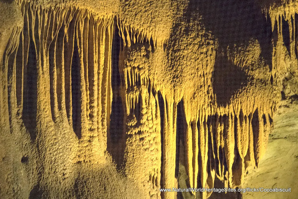
Location and Values: Mammoth Cave National Park is located in east-central North America in the US state of Kentucky. It lies on sedimentary limestone beds to the west of the main Appalachian mountain range, and is thought to have the world’s largest network of natural caves and underground passageways (including 560 km that have already been surveyed and mapped). The system includes examples of nearly every type of limestone cave formation and is richly decorated with a variety of speleothems including stalactites and stalacmites, beautiful gypsum flowers and needles, mirabilite flowers and sulfate mineral deposits. Above ground the topography and geological features exemplify all the classic features of a limestone karst landscape within an extensive drainage system including sink holes, cracks and fissures leading into a complex network of underground channels, conduits and passages. The underground cave system supports an exceptionally rich fauna with 130 recorded species, including 14 species that are known only from Mammoth Cave such as a blind white fish and a white eyeless crayfish. These species demonstrate the process of evolution in an environment without light, where body pigments are lost and eyes are no longer required.
Conservation Status and Prospects. According to IUCN’s Conservation Outlook Assessment (2020) the conservation status of Mammoth Cave National Park is ‘good, with some concerns’. The IUCN report notes that most of the cave system has been created over millions of years and serves as a robust geological feature. Nevertheless there is some concern over air and water pollution, especially from neighbouring coal-powered power plants which might affect the cave fauna and perhaps the dissolution processes that create the limestone caves. Exceptional flooding of the caves resulting from storm water drainage of surrounding urban areas could also damage some cave passageways and the development of cave formations, while there is also the risk of damage to the fragile cave formations by visitors in the few passages that are open to the public. There is also concern over a decline in the bat population at Mammoth Cave National Park, resulting from the spread of a lethal fungal disease, and concern over the spread of invasive alien species in the woodlands above ground.
Links:
Google Earth
Official UNESCO Site Details
IUCN Conservation Outlook
UNEP-WCMC Site Description
Slideshow description

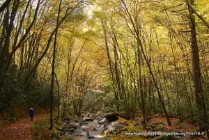
The slideshow ‘tells the story’ of Mammoth Cave National Park starting at the park entrance and visitor centre before entering the caves. Access to the caves is strictly controlled and only about 15km of the 560 km of surveyed passages are open to the public. The slideshow illustrates the variety of cave formations (technically known as ‘speleothems’) that can be seen on a typical cave tour, and one of the unique cave animals, a white cave crayfish (as an example of a cave-dependent ‘troglobite’). The final part of the slideshow illustrates some of the geological and other features of the park above ground, with its dense deciduous forests, waterfalls and sink holes.
The following Flickr photographers and other sources are acknowledged with thanks for their contributions to this slideshow: Barrie79, NPS, Cocoabiscuit, Daveynin, David Ellis, Eric Blackenship, Henry Huey, James StJohn, Jo, John Iwanski, John Skodak, JS Hyun, Kristen Bobo, L. Allen Brewer, Stanislav Vitebskiy, Tom Gill and Vladeb.
Factfile
Website Category: Caves & Karst
Area: 212 km2
Inscribed: 1981
Criteria:
- Exceptional natural phenomenon (vii);
- Outstanding natural beauty (vii);
- Geological features (viii);
- Natural habitat for biodiversity (x);
- Significant number of rare, endemic and/or endangered species (x)