EXPLORE THE SAGARMATHA NATIONAL PARK with this slideshow, check the location map and get all the facts and information below.
For slideshow description see right or scroll down (mobile). Click to view slideshow

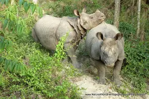
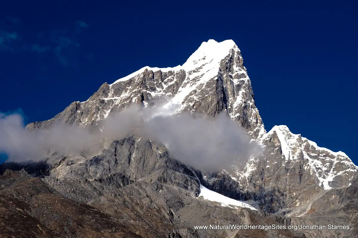
Location and Values: Mount Everest (known locally as Sagarmatha) is the world’s highest summit (8,848m) and one of eight peaks above 7,000m that lie within the scenically spectacular Sagarmatha National Park. The park is located at the geographic centre of the Himalayas, the great mountain range created by the collision of the Indian and Asian land masses. It’s world heritage status recognizes the unique position of Mount Everest as the world’s highest point, and the exceptional natural beauty of the surrounding mountains. In addition, the area supports an enormous diversity of wildlife habitats, vegetation types and biodiversity on account of its wide altitudinal range (more than 6,000m) from rock-and-ice mountain summits, through alpine pastures to conifer and broad-leaved monsoon forests. Furthermore, it is home to about 6,000 Sherpa inhabitants who follow a largely traditional lifestyle and practice a (Buddhist) religion that respects nature and favours sustainable management of resources.
Conservation Status and Prospects. According to IUCN’s Conservation Outlook Assessment (2017) the conservation status of Sagarmatha National Park is of ‘significant concern’. The IUCN report notes that ‘ Sagarmatha National Park was one of the earlier sites to be inscribed onto the World Heritage List and remains a globally iconic place of scenically arresting grandeur. The property has become an increasingly popular tourism destination especially among trekkers and mountaineers who today take advantage of the improved access afforded by aircraft. The property is suffering from a suite of long-standing and growing threats related to tourism impact (uncontrolled development, pollution, waste management, energy demand, and intrusive aircraft), deforestation, unsustainable resource extraction and disruption to Sherpa social structures. Climate change impacts are poorly understood but known to be affecting fire frequency and severity as well as precipitation patterns which heighten the risk from glacial lake outburst flooding. Management responses to the problems are commendable but failing to keep pace with the pressures on the park. SNP awaits a revised management plan which is especially critical to specify how tourism should be managed. The long running legal case with the Kongde View Tourist Resort, built in 2005, adds to the impression that tourism is not being effectively planned and managed.’
Links:
Google earth
Official UNESCO Site Details
IUCN Conservation Outlook
UNEP-WCMC Site Description
Birdlife IBA
Slideshow description

The slideshow is intended to ‘tell the story’ of the Sagarmatha National Park, and features a portfolio of photos from a 14-day trekking expedition by Alexander Howarth and Jonathan Starnes in October 2017. In addition some aerial photos of the wider Himalayas and the summit of Mount Everest taken by Peter Howard during a ‘scenic flight’ out of Kathmandu are included (surely a much easier way to view Mount Everest!). Finally there is a small collection of photos from the Tibetan side of the border, showing the ancient monastery and small collection of temporary buildings that mark ‘base camp’ on the northern flanks of the mountain (photos by Peter Howard in 2004).
The trek chronicled by Alex and Jonathan follows the ‘classic’ Everest Base Camp route out of Lukla, following a ‘circular’ path that includes a crossing of the Cho La Pass and return to Namche Bazar via Gokyo. The first part of the journey for most trekkers involves a nerve-wracking flight into Lukla, a short mountainside airstrip that allows access to small turbo-prop aircraft when weather conditions are favourable. As well as being the ‘Gateway to Everest’ it is famously dubbed ‘the world’s most dangerous airport’. The trek itself descends initially out of Lukla, across a series of spectacular suspension bridges through forested river gorges, before a steep climb into Namche Bazar. Namche is a hub of urban living with buildings arranged around a natural amphitheatre on an upland plateau in the park interior, with a multitude of hotels, guest houses, stores, bars (and a fine German bakery!). From here many trekkers spend a day acclimatizing to altitude by making a day trip to the Everest View Hotel – taking in the panorama of other high peaks such as Ama Dablam along the way. Just outside Namche there is a small museum and a monument to Tensing Norgay Sherpa, the first Nepali to summit Everest (with Sir Edmund Hillary). From Namche the trek to Lobuche (4910m) takes three days, with some spectacular views of the high peaks – Everest, Lhotse and Ama Dablam – along the way. Just before Lobuche is the Everest Memorial Site, where a stone memorial has been built for each of those who have perished in the attempt on Everest. Beyond Lobuche it is a short hike to the next overnight stop at Gorak Shep (5,125m), from where visits are made to Everest Base Camp and the rocky summit of Kala Patthar (a torchlight procession in the early morning!). The summit of Kala Patthar offers trekkers the best views of Everest, which seems to be within touching distance as the early morning light strikes its glistening icy flanks. Alex and Jonathan’s descent route took them down to an overnight stop at Dzonglha (4,800m), then over the Cho La Pass (5,330m) to Dragnag and across the Ngozumpa Glacier to lakeside Gokyo.
Factfile
Website Category: Mountains, Top 10
Area: 1,244 km2
Inscribed: 1979
Criteria:
- Exceptional natural phenomenon (vii);
- Outstanding natural beauty (vii)