EXPLORE the Okefenokee National Wildlife Refuge with this slideshow, check the location map and get all the facts and information below.
For slideshow description see right or scroll down (mobile). Click to view slideshow
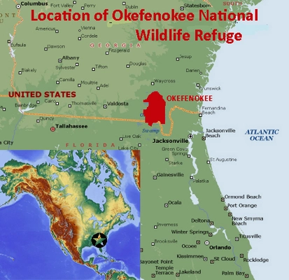
Location and Values: The Okefenokee National Wildlife Refuge (ONWR) protects the fragile blackwater ecosystem of the Okefenokee Swamp and its associated mosaic of pine savanna, forest, floating peat prairies and wetland habitats. It is located in the southeastern USA, straddling the border between the States of Georgia and Florida within the North American Coastal Plain (NACP) global biodiversity hotspot (one of only 36 such hotspots recognized globally). The Okefenokee Swamp serves as the watershed between two rivers, one of which flows east into the Atlantic, the other southwards into the Gulf of Mexico.
The swamp is characterized by giant 400-year old buttressed cypress trees, festooned with hanging Spanish lichen, with areas of open water and channels running between the trees. Drier areas of pine savannas are found around the margins of the swamp and on islands within. Below the surface, the swamp has intact peat deposits up to 5 metres deep built up over 7,500 years and providing evidence of environmental and climatic changes over this long period. It is considered to be the largest subtropical freshwater peatland in the world and serves an important role as a carbon sink helping mitigate the impacts of present-day climate change.
The ecology of the site is driven by the dynamic interplay of fire and water. The high biodiversity relies heavily on natural, lightning-ignited wildfires that burn through the pine savannas and swamps, preventing shrubs from overtaking the herbaceous, grassy ground cover.
In addition to the important wetland and swamp habitats the Okefenokee National Wildlife Refuge protects some of the last remaining intact areas of southern longleaf pine woodlands. This endangered ecosystem occurs only in the southeastern USA, where just 3% of its original area remains. Although the ONWR covers only 0.15% of the NACP hotspot (which extends from Texas through the southern and eastern states as far as Maine) it is large enough to protect some of the hotspot’s most important natural habitats and a representative number of its species.
Characteristic animals include a large population of American Alligator, 12 species of freshwater turtles, Gopher tortoises, Florida black bear, river otters, bobcats and 238 species of birds including sandhill cranes, wood storks, white ibis and red-cockaded woodpecker. Overall the ONWR is home to 59% of the NACP hotspot’s vertebrate species (about 425 species), including 41% of its endemic reptiles and amphibians. Species totals for other taxa are less impressive, perhaps in part due to limited species inventory work. The Refuge protects 24 species classified as Critically Endangered, Endangered or Vulnerable on the IUCN Red List, mainly plant species, reptiles and birds. In addition to the species mentioned above these include the endemic Okefenokee Giant Pitcher plant, Hairy Rattleweed, Greenfly Orchid, Eastern Indigo Snake, Gopher Frog, Bachman’s Sparrow and Swallow-tailed Kite.
Links:
Google Earth
Slideshow description
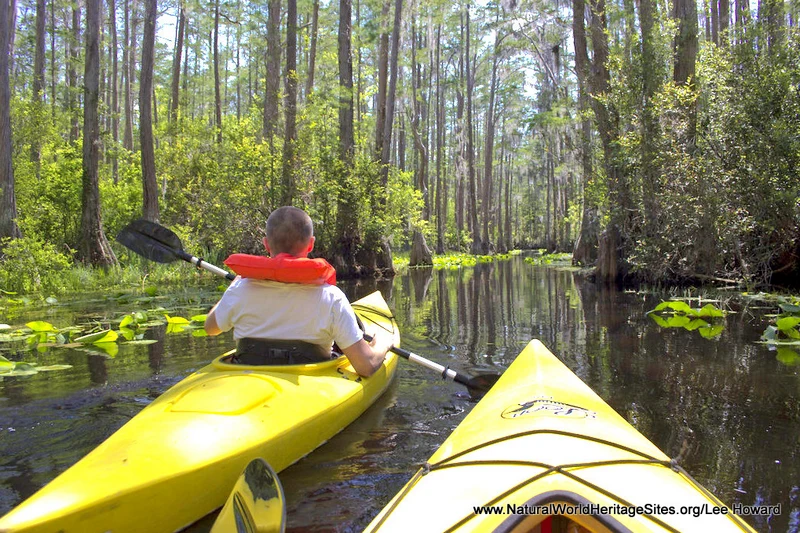
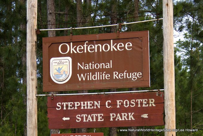
The short slideshow illustrates some of the habitats, plants and animals of the Okefenokee Swamp, including the main habitats and vistas experienced from the water in a kayak. Starting from the boat hire jetty in the Stephen Foster State Park, the photos show the giant cypress draped in Spanish moss, traversing open water in Billys Lake and the narrow channels through to Minnies Lake. Species such as American Alligator, Barred Owl and Turtles are commonly encountered, while aquatic plants include white lilies, bullhead lilies and golden club. Photos are mainly attributed to Lee Howard, with additional contributions from flickr photographers Kathryn Adams, Matthew Hansen, supernova1980 and John-on-time. Photo credits are provided in the watermarks of each image.
Conservation Status and Prospects. The hydrological and ecological integrity of the Okefenokee National Wildlife Refuge is excellent, thanks to its situation on a watershed supplied by rainwater and providing it to surrounding areas, rather than receiving water from upstream catchments. This makes it distinct from other major wetlands on the World Heritage List which are vulnerable to upstream water abstraction, dam construction and pollution. It is noteworthy that most of the major freshwater wetlands on the World Heritage List are either inland deltas (such as the Pantanal and Okavango Delta) or coastal deltas and wetlands (such as the Everglades, Danube Delta, Donana, Sundarbans, and Isimangaliso) which are much more vulnerable and threatened than Okefenokee.
Nevertheless, the ONWR could potentially be impacted by activities outside the site which affect groundwater flows, lowering the water table and leading to undesirable ecological changes within the ONWR. Industrial forestry, water use for agricultural irrigation, urban expansion or mining could all affect the delicate hydrological balance. There has been a proposal for mining of industrial mineral sands on Trail Ridge (the ancient sandbar forming the eastern boundary of the swamp) which threatened to alter seasonal water levels, potentially devastating the delicate peat mat ecosystems where threatened plants (such as the carnivorous pitcher plants) thrive. This proposal has been rejected and lands previously held by mining companies have now been incorporated into conservation of a de facto ‘buffer zone’ for the site.
Although the World Heritage Site has no formally recognized ‘buffer zone’, there are extensive areas (amounting to 1,260 km²) under conservation management to the north and south of the ONWR, including the Dixon Memorial State Forest, John M. Bethea State Forest, Osceola National Forest and parcels of land owned by The Conservation Fund. In addition, a habitat buffer zone is being created around the entire Refuge by the Greater Okefenokee Association of Landowners to preserve upland habitats and protect the hydrological regime of the area. These conservation measures in the wider landscape serve to further strengthen the conservation prospects for the ONWR.
In terms of possible future threats to the site, climate change is the biggest unknown. It is thought likely that the area will experience more intense storms and drought periods, with unknown consequences for the underlying hydrological and ecological balance.
Factfile
Website Category:
Lakes, freshwater wetlands & glaciers;
Area: 1,646 km²
Inscribed: 2026
Criteria:
- Ecological processes (ix);
- Natural habitat for biodiversity (x);
- Significant number of rare, endemic and/or endangered species (x)

