EXPLORE China’s Huanglong Scenic and Historic Interest Area with this slideshow, check the location map and get all the facts and information below.
For slideshow description see right or scroll down (mobile). Click to view slideshow

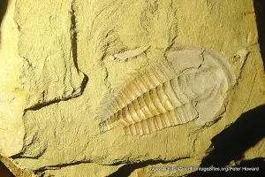
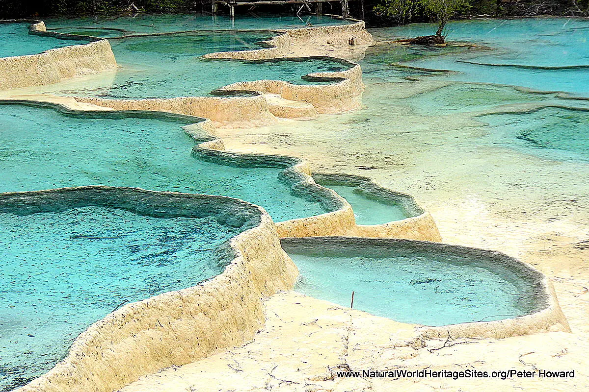
Location and Values: The Huanglong Scenic and Historic Interest Area covers 600km 2 of the MinshanMountains, occupying the entire upper catchment of the Fujiang River in the north-west of Sichuan Province. It covers a diverse range of vegetation and habitat types including numerous snow-capped peaks above 4,800 m, alpine meadows, coniferous and subalpine forest with mixed evergreen forest below 2,300m. Its most unique feature is the (relatively small, 15km 2 ) Huanglong Valley where there is an exceptional series of travertine pools that are reckoned to be scenically equivalent to those at Yellowstone (USA) and Nahanni (Canada) and more impressive than those at other world heritage sites such as Plitvice (Croatia) and Hierapolis-Pamukkale (Turkey). The site includes the most easterly of China’s glaciers and the highest peak in the Minshan Mountains (Snow Treasure Peak, Xuebaoding, 5,568 m) as well as the spectacular 20 km-long Danyun Gorge. The forested mountain slopes support populations of endangered species such as the giant panda and Sichuan golden snub-nosed monkey.
Conservation Status and Prospects. According to IUCN’s Conservation Outlook Assessment (2014) the conservation status of the Huanglong Scenic and Historic Interest Area is ‘good, based on the overall effective management regime established by the authorities during the time since the property was inscribed on the World Heritage list. The threat from undesirable impacts of mass tourism development remains of some concern. The authorities need to be vigilant against continuing and growing pressure from increasing numbers of visitors and development of more facilities and services infrastructure. Judicious intervention is required to combat overdevelopment in excess of the environmental and social carrying capacity of the property. The site is located in a global hotspot area of earthquake and landslides and threats from natural disasters need to be more fully incorporated into the management of the site and disaster risk management capacity needs to be enhanced.’
Links
Google Earth
Official UNESCO Site Details
IUCN Conservation Outlook
UNEP-WCMC Site Description
Birdlife IBA
Slideshow description

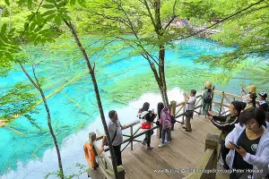
The slideshow is intended to ‘tell the story’ of the Huanglong Scenic and Historic Interest Area, and features a portfolio of photos from a visit by Peter Howard in early June 2017. The slideshow begins at the main (western) road access point on the Snow Ridge (3960m), marked with a stupa and Tibetan prayer flags and providing far-reaching views into the nearby peaks of the Minshan mountains. In the distance the snow-covered Xuebaoding (Snow Treasure Peak, 5568m) can be seen, while the alpine meadows at the pass are punctuated by some spectacular karst rock outcrops. The majority of the photos that follow are taken in the small Huanglong valley, where extensive deposits of calcite form a long series of travertine terraces and stunning colourful pools stretching for about 3.5 km along the valley floor. This is a very heavily visited area, most easily accessed by cable car, which transports visitors into a pristine coniferous forest with an understorey rich in rhododendrons near the head of the valley. The most spectacular concentration of terraces and pools is found at the head of the valley, where Five-Colour Pool is flanked by a couple of historic Buddhist temples, and a boardwalk for visitors that provides a good vantage point for viewing while protecting the terraces and pools from damage. The system of boardwalks continues through the valley past further pools and formations, each with its own poetic name – Beauty-competing pond, Body-washing cave, Mirror pond and Golden Sand Beach. Some of the pools remain dry for at least six months of the year, being replenished during the summer rains (so the best time to visit is June to November). This is also an important area for biodiversity and careful observation might reveal the rare Sichuan golden snub-nosed monkey, squirrels and ground orchids. The second part of the slideshow covers the Danyun Gorge, which is accessed via the main east-west road through the site. The high pastures above the gorge are occupied by Tibetan pastoralists who live a relatively simple life herding their yaks between grazing areas in the high mountains. The forested slopes that surround the gorge are enormously diverse, with distinct ecological communities in different altitudinal zones. The site covers a range of altitude from 5,588 to 1,700m, with high altitude alpine scrub and coniferous forests replaced by increasingly diverse communities of evergreen broadleaf forests at lower elevations. These forests provide habitat for a range of highly endangered species including giant pandas.
Factfile
Website Categories: Mountains; Caves & Karst
Area: 600 km2
Inscribed: 1992
Criteria:
- Exceptional natural phenomenon (vii);
- Outstanding natural beauty (vii);