EXPLORE Chaine des Puys – Limagne Fault Tectonic Arena with this slideshow, check the location map and get all the facts and information below.
For slideshow description see right or scroll down (mobile). Click to view slideshow

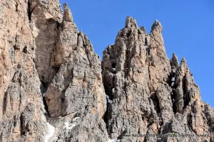
Location and Values: The Chaine des Puys – Limagne Fault Tectonic Arena is located in central France, to the west of Clermont-Ferrand. It is a relatively small area with distinctive landscape features, which illustrates the geological processes associated with the break-up and collision of Earth’s tectonic plates. Specifically, the area inscribed on the world heritage list lies along the West European Rift and includes features that demonstrate how the continental crust was cracked and uplifted in this part of Europe following the formation of the Alps 35 million years ago (when the African tectonic plate collided with the European one). Three main landscape features are included in the site – an alignment of small (extinct) volcanic cones (the Chaine des Puys), a shallow escarpment that marks the edge of the rift (the Limagne Fault), and a long ridge that originated as a volcanic lava flow (the Montagne de la Serre). Some of these features are clearly visible in the landscape, while others require more specialist knowledge to identify and understand.
Conservation Status and Prospects. The Chaine des Puys – Limagne Fault Tectonic Arena is a recent inscription on the world heritage list which IUCN considers to be adequately protected in respect of its geological values. In its evaluation IUCN notes that ‘the property has been subject to management and preservation measures for nearly one hundred years, under the impetus of local actors and supported by the State. Critical to protecting the property’s Outstanding Universal Value is preventing any degradation to the geological features and maintaining, even accentuating, their visibility in the landscape. The main potential threats are thus the quarries, urbanisation, encroachment of forest masking the geological features, and erosion of soils linked to human action. All of these threats are managed via a combination of regulatory measures, an integrated management plan, and the availability of dedicated human and financial means.’
Slideshow description

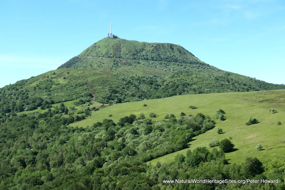
The slideshow ‘tells the story’ of the Chaine des Puys – Limagne Fault Tectonic Arena with a portfolio of photos by Peter Howard from a three-day visit in June 2019. They illustrate the landscape features which contribute to the area’s ‘Outstanding Universal Value’, starting at the iconic volcanic dome of the Puys de Dome. From the summit, far-reaching views of the Chaine des Puys alignment of around 80 volcanoes stretching to the horizon in a tight northerly and southerly direction can by appreciated. This is reckoned to be the most closely grouped collection of domes, cones and maars (different forms of volcano) anywhere on Earth. For most visitors the summit of the Puys de Dome is the single most important vantage point from which to gain an appreciation of the volcanic nature of the area (although taking to the skies in a hot air balloon, para-glider or light aircraft is even better!). Immediately to the north of the Dome is the distinctive cone and crater of the Puys de Pariou, one of the few volcanoes in the Chaine which is not covered in tall trees (which elsewhere obscure some of the distinctive features).
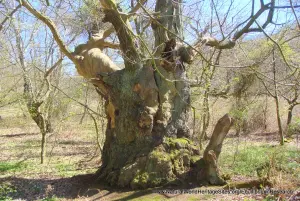
After the initial overview of the chain of volcanic cones visible from the Puys de Dome the slideshow ‘takes a tour’ of the site, illustrating particular features and points of interest from the far north, working southwards. The Chateau de Tournoel is located in the far north, on the top of the Limagne Fault escarpment. From the village below its ramparts the alignment of the wooded hillsides of the escarpment can be seen. Most of the world heritage site lies on privately owned land, with active agriculture and commercial forestry, so access is restricted. The slideshow illustrates the (obscured) views from a typical forested peak at the Puy Chopine, before returning to the Puys de Dome for a more comprehensive look at its features – with para-gliders overhead, taking in the towering telecommunications installation, visitors centre, sheep pastures, crowds of visitors and commanding views in all directions. The tour continues with a visit to the Puy de Gravenoire, a fabulous viewpoint on the edge of the escarpment above Clermont-Ferrand, providing another good perspective on the alignment of the Limagne Fault.
The photos that follow illustrate views of the ‘classic cone’ and crater of the Puy de Pariou and the beech forests on its flanks, before moving south to the Puys de la Vache and adjacent Puy de Lassolas. Here some conspicuously volcanic lava bombs, boulders and flows can be seen, and the U-shaped outlines of the collapsed craters become obvious to walkers ready to climb to the summit and walk the crater rim. In the distance the outline of the Lac de la Cassiere and Lac d’Aydat can be seen, two lakes that are important to the ‘story’ of the site because they were created by lava flows originating from the Puys de la Vache that blocked the natural flow of the rivers. The slideshow concludes with two interesting sites in the south of the Chaine de Puys, namely the Narse d’Espinasse (a maar volcano, where the (former) crater lake has been filled with sediment, forming a bog) and the Puys de Combregasse, one of the higher peaks in the south which is being cleared of trees to enable the expansive views from its peak to be appreciated. On the lower slopes of this extinct volcano, rocky protrusions punctuate the sheep pastures, testimony to underground lava flows that spilled onto the surface here.
Factfile
Website Categories: Earth Features;
Area: 242 km2
Inscribed: 2018
Criteria:
- Geological features (viii);