EXPLORE VIETNAM’S TRANG AN LANDSCAPE COMPLEX with this slideshow, check the location map and get all the facts and information below.
For slideshow description see right or scroll down (mobile). Click to view slideshow

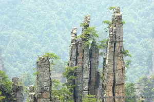
Location and Values: The Trang An Landscape Complex is a small area of spectacular limestone and karst scenery on the southern margins of the Red River Delta in northern Vietnam. It includes many ‘classic’ karst landforms including cones, rock towers and ridges with steep canyons, cliffs, subterranean rivers and decorated caves. The area shares many of these features with other karst landscape areas in the wider region, including Halong Bay and the series of sites in the South China Karst world heritage site. In addition to its spectacular natural scenery and geological values, the area provides archaeological evidence of 30,000 years of human occupation and the ancient capital of Vietnam, Hoa Lu, was established here in the 10th and 11th centuries AD.
Conservation Status and Prospects. According to IUCN’s Conservation Outlook Assessment (2014) the conservation status of this site is of ‘significant concern’. The IUCN report notes that ‘while the values remain in good condition, the boundaries of the property contain areas which detract from core values; there are concerns regarding the standards and consistency of legal protection over the site; and weaknesses in the management planning framework and zoning systems. Of greater concern is the threat of rapidly increasing tourism pressure on the site in the absence of a clear plan and measures to mitigate potentially negative consequences. The property has the potential to become a major tourism asset for Ninh Binh Province and Vietnam but must be very carefully managed to avoid impact and to retain a quality visitor experience.’
Links
Google earth
Official UNESCO Site Details
IUCN Conservation Outlook
UNEP-WCMC Site Description
Slideshow description

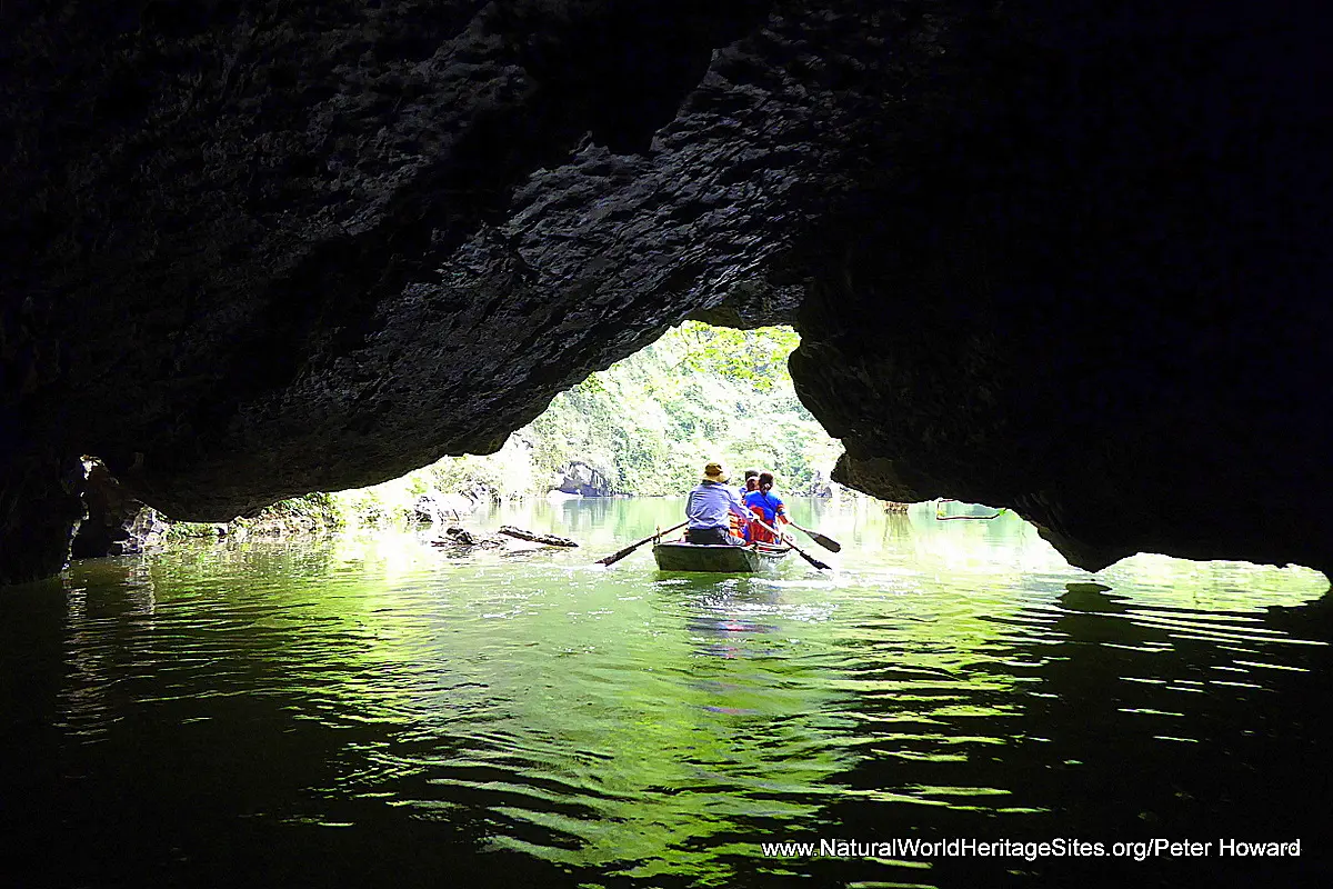
The slideshow is intended to ‘tell the story’ of the Trang An Landscape Complex, through a portfolio of photos from a visit by Peter Howard in May 2017. The slideshow begins with some archaeological exhibits (ancient pottery fragments) at the main Trang An visitor centre, before showing the landscape features and some of the temples seen from the ‘standard package’ boat tour of the site. The subterranean rivers are a particularly impressive feature, and these can be navigated in shallow flat-bottomed rowing boats (as long as you keep your head down when passing through the low cave passages!). Three of the temples that are visited as part of the standard tour are shown, as well as the karst features and natural undisturbed vegetation of the site. From Trang An, the slideshow provides some photos from an outstanding vantage point above the Mua Cave, where typical needle-sharp karst rock erosion is visible and there are stunning views over the steep-sided valley of the Ngo Dong River. Further ‘close encounters’ with the dramatic karst landscape are then shown from the Tam Coc area, where large numbers of foot-rowed boats ferry visitors on an exhilarating and intimate journey through further low-hung caves and past massive limestone cliffs. The slideshow includes a few photos of a charming cluster of cave temples on the edge of the world heritage site (known as Bich Dong Pagoda) and shows some of the conservation issues that affect the natural integrity of the wider landscape – a cement factory, high-rise buildings and electricity pylons as well as invasive exotic species such as the water hyacinth. The slideshow finishes at the ancient capital of Hoa Lu, most of which has been destroyed, but two restored temples are featured.
Factfile
Website Category: Caves & Karst
Area: 62 km2
Inscribed: 2014
Criteria:
- Outstanding natural beauty (vii);
- Geological features (viii)